NOTO ANCIENT, FROM THE DAWN OF SICILY

Photo Source: Antonino Rampulla
The current
Noto, the well-known capital of the Sicilian baroque, is a
city-work of art erected following the disastrous earthquake of 1693 by brilliant minds of the time. However, the original
Noto, pre-existing to Greek colonization, probably of the matrix
sicula, held in high esteem by the Greeks, then
foederata Roman like Messina and Taormina, which gave its name to the homonymous Vallo (one of the three in which Sicily was first divided into the Arab era, then Norman), or rather, the remains of that city that it was once the magnificent Netum, located on the ridge of Mount Alveria, ten kilometers from today's site.
At Noto Antica we arrive from Noto continuing on the SS287 towards the Iblei, and then turn left on the SP64. Unfortunately, the last stretch of road, about 750 meters, is extremely complicated to travel, because, even if paved, it narrows almost to a single lane, with few openings in which to approach to allow the passage to cars that come from the opposite direction. In Noto Antica you can only get there by own means, as no public transport service arrives there. The archaeological site is not guarded, admission is therefore free and can be entered at any time of the day. The car can be left near the entrance, in a sort of unguarded parking lot. Inside the archaeological park, the circulation to private cars should theoretically be forbidden, but every now and then I seemed to see along its main path of cars that did not show the signs of the forest police ...

The Parco dell'Alveria is the set of archaeological areas that include broadly Noto Antica in the south and a Necropoli of probabilissima sicula origin north. The two areas are separated because Noto Antica, especially on the side of Porta della Montagna, that is from the main entrance, is bounded by the imposing sixteenth-century walls that resisted the devastating earthquakes of the 1693. The depth and the invoice of these walls give the measure of how important the city of Noto was in ancient times. At the entrance there are two maps: the first, canonical, depicting the paths and ruins of the park; the second, extremely interesting, depicts the original Noto that a Franciscan friar had in time to draw a few years before the earthquake, a great help for the identification of the exact location of the ruins. The last time I had the pleasure of walking down the path was in mid-September 2017, with a pregnant wife and two-year-old daughter in a stroller. The day was not too hot, fortunately. To reach the almost immediate Castello Reale I had to leave the stroller down and pick up the baby: know then that enter the archaeological site of Noto Antica is more like a medium difficulty trek , what a walk on the promenade of Marzamemi ... So equip yourself well. Otherwise you can always stay on the easiest main path to meet the ruins of the New Hospital, of the Palazzo Landolina of Belludia or of the Jesuit College. But if you want to reach for example the Arab Tanneries or the Greek Ginnasio know that with pregnant wife and two-year-old daughter in tow, it is quite complicated ...

Noto Antica gives rise to conflicting emotions. If you pretend to proceed for an unexplored territory, invaded by the disorderly vegetation typical of these altitudes and latitudes, in which almost by chance you can see ancient ruins of which nobody knows anything yet, then we forget that in truth it is archaeological site of great historical importance, because here they have placed a residence, as suggested by the nearby necropolis of Culture of Castelluccio, Sicani, Siculi, Greeks, Romans, Byzantines, Arabs, Normans, Aragonesi et cetera, before the devastating earthquake of the Val di Noto radiated almost everything to the ground. Then we forget that those complicated paths to travel, that lush vegetation that encompasses everything, rhymes with carelessness ... Certainly, the irregular course of the paths with branches, steps, widenings that were once lived and frequented squares, such as for example Piazza Maggiore, is typical of a medieval structure. But this does not justify the state of semi-abandoned: once that path with stairs was passable even without trekking boots ...
In recent years, however, there has been a renewed interest in Noto Antica, also by the Municipality of Noto in an attempt to involve also the Superintendency and University. A not inconsiderable advantage of the archaeological site of Noto Antica, is not to be located below a modern town, in which public interests in case of archaeological findings would clash with private ones, resulting in obstructionism when not in real and own judicial disputes. For example, in Rome, wherever excavations are found, there are remains and archaeological finds, then bureaucratic skeins to be untangled, as for example during the recent work of expanding the subway. In Messina, a city hit several times by devastating earthquakes (the last one in 1908), rebuilt on its rubble, often rumors of alleged findings from construction companies, hurriedly covered to not see the works blocked by the Superintendency. br>
Regardless of making it a tourist attraction, the Archaeological Park of Alveria should be better taken care of and investigated, also proceeding with new excavations, above all in order to deepen the prehistory of Sicily and the Mediterranean that, from a recent discovery by the Sicilian archaeologist, Davide Tanasi, would seem a little different from what we have studied on school books.

If the origin
sicula of Noto was established (but to do so, unfortunately, they would need funds and excavations that are not there) would further confirm the thesis that
the Sicilian peoples, in the era prior to the Greek colonization, would have had a cultural level not too far from the Hellenic. The recent discovery by Davide Tanasi of traces of wine, near Sciacca, dating back to the 4th millennium BC, or about two millennia before the advent of
siculi and
sicani, evidence that the history of Sicily should be partly rewritten, because
the process of vinification concerns a "technological" level not attributable to typically prehistoric cultures. Considering also that in the same period the culture of wine conservation was spreading, as well as wine-making, also in Armenia and in Greece, and that in Sicily there was a large quantity of metal instruments not consistent with the mineral availability of the island. , it is not impossible to hypothesize extra-island commercial relations, therefore a cultural level much more advanced than until recently believed.
To get their research funded, prof. Davide Tanasi has had to address the University of South Florida: the Italian university system continues to prove to be at the forefront in enhancing its best minds ...
Text Source: Antonino Rampulla
ARCHIVE NEWS
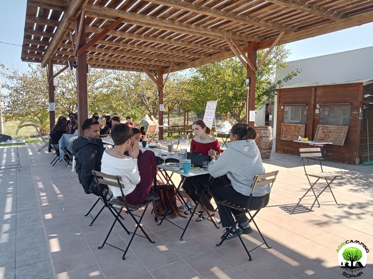 DO YOU WANT TO ORGANIZE AN ERASMUS AT AGRICAMPING SOPHIA?
WHAT IS AGRICAMPING SOPHIA?
It is a campsite with tent pitches, glamping tents, mobile homes and bungalows
WHERE IS IT?
In Italy, in Sicily, near Syracuse, in Pachino: 36.736883, 15.095610
HOW TO CONTACT US?
info@agricampingsophia.it
(SPEAK ENGLISH) +39 3473079242 – (ONLY SPEAK ITALIAN) +39 3452396095
WHAT DO WE OFFER?
We offer hospitality and catering for Erasmus projects
FOR HOW MANY PEOPLE?
We can have 4-7 single beds in the Socrate Bungalow, 6-10 single beds in the Platone Mobile Homes, 4-6 single beds in the Aristotele Mobile Homes, 4 single beds in the Iblone Mobile Homes, 4 single beds in the single beds in the Empedocle Glamping Tents. In total we therefore have 18 comfortable single places or 31 single places with a fair spirit of adaptation.
IN WHICH PERIOD CAN AGRICAMPING SOPHIA BE AVAILABLE?
The most suitable periods to use our services...
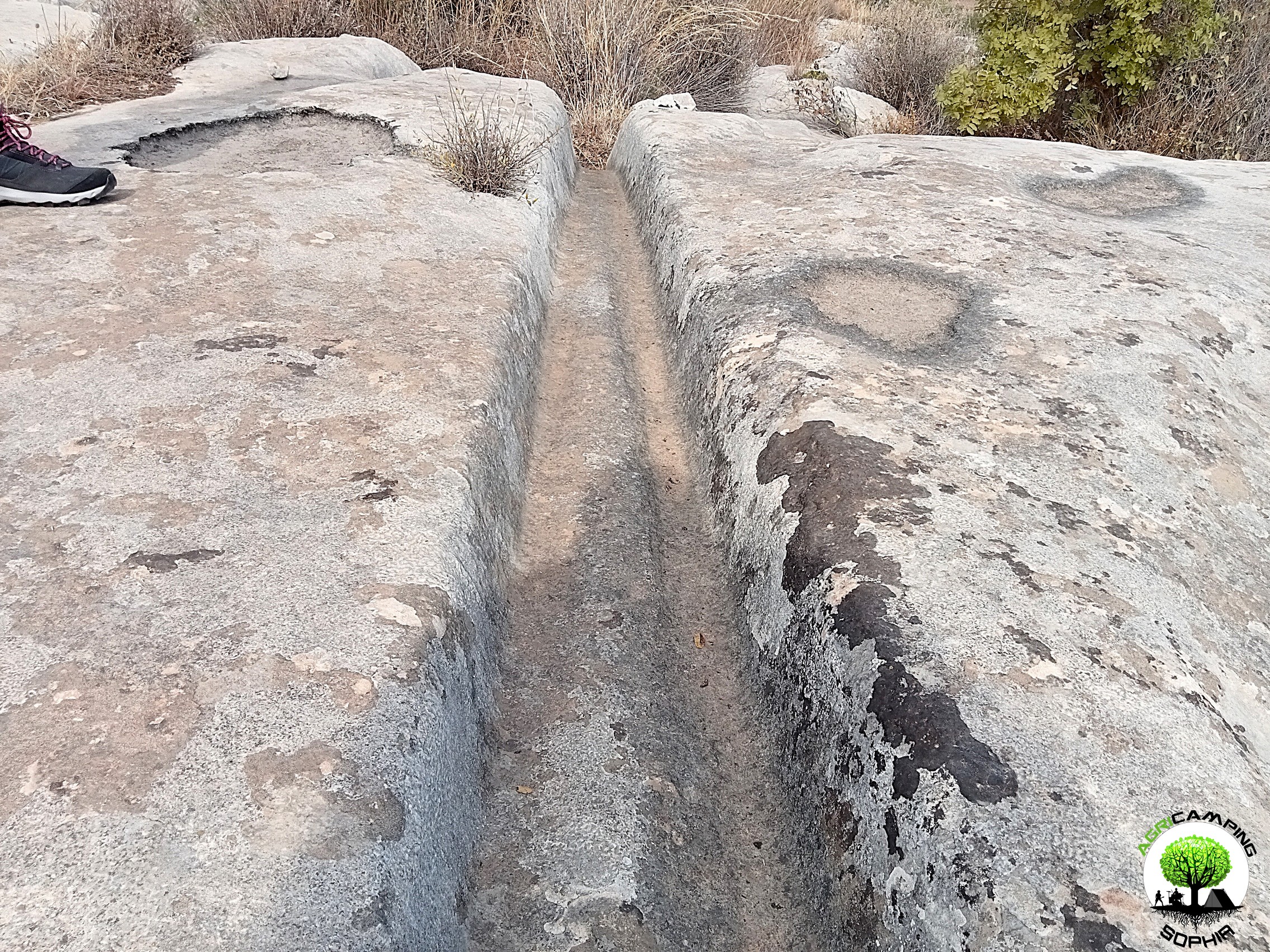 CART RUTS MODELED ON SOFT ROCK?
Read also RACK OR HOUSING FOR CLOGS?
Some cart ruts from the Targia district, in Syracuse, and most of the cart ruts from Granatari Vecchi, in Rosolini, give the impression of having been impressed, modelled, on a rock that was originally viscous, not entirely solid. As absurd as this hypothesis may seem, especially in Granatari Vecchi, the softness of the shapes and the at least anomalous uniformity of the rock bank, as if it were a concrete casting, which hosts the cart ruts, is unicum compared to the lithic context in the area.
In Targia this phenomenon is less impressive but if we consider the cart ruts essentially cart tracks, therefore furrowed roads indirectly resulting from the repeated passage of carts along the same route, we do not understand why such uniformity and smoothness is present, in the majority of cases, also on the parts not affected by the passage of the...
 RACK OR HOUSING FOR CLOGS?
Read also CART RUTS CUT FROM QUARRIES
In the presence of slopes, even slight ones, in some cart ruts in the Targia district, in Syracuse, central holes are found with a diameter of between 30 and 50 centimeters and a depth of 15-20 centimeters, spaced about 50 centimeters apart. Neither the position (they are not exactly in the center of the cart ruts and perfectly aligned with each other), nor the shape appear perfectly regular: either the passage of time and any wear have profoundly modified their original shape or, simply, they have never had a systematic regularity. However, the offset in position between one hole and another is never completely “off-axis”: there is always a portion about twenty centimeters wide that coincides with the same portion of the previous and subsequent hole. The best preserved and most defined holes are found in the cart ruts usually called Scala...
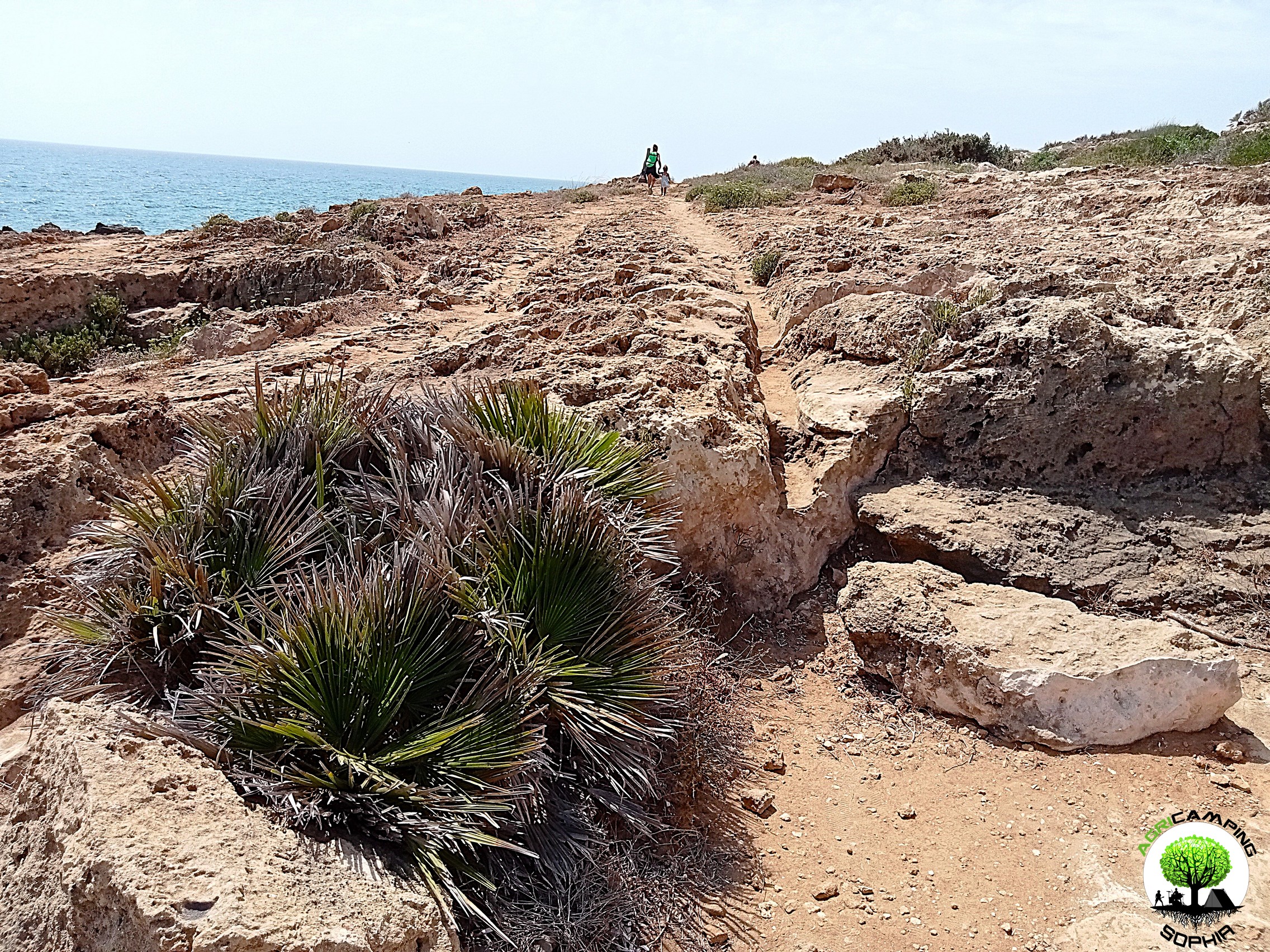 CART RUTS CUT FROM QUARRIES
Back to CART RUTS AND A FEW TOO MANY PROJECTIONS
I will skip any preamble, referring to what has already been written regarding the presence of cart ruts in south-eastern Sicily.
The easy academic tendency has been, in most cases concerning cart ruts, to consider them in terms of the latomie, or quarries, with which very often (for example in the cases of the Targia or Pizzuta districts) they share the same territory.
According to this theory, the carraie would have been indirectly created due to the wear of the rock at each passage of carts or sleds loaded with extracted stone blocks. I will not repeat the arguments presented so far in order to demonstrate that this is a theory that has little solid foundations on an in-depth analysis of the cart ruts. However, I will add a piece by demonstrating the implausibility of a connection between them in both chronological and functional...
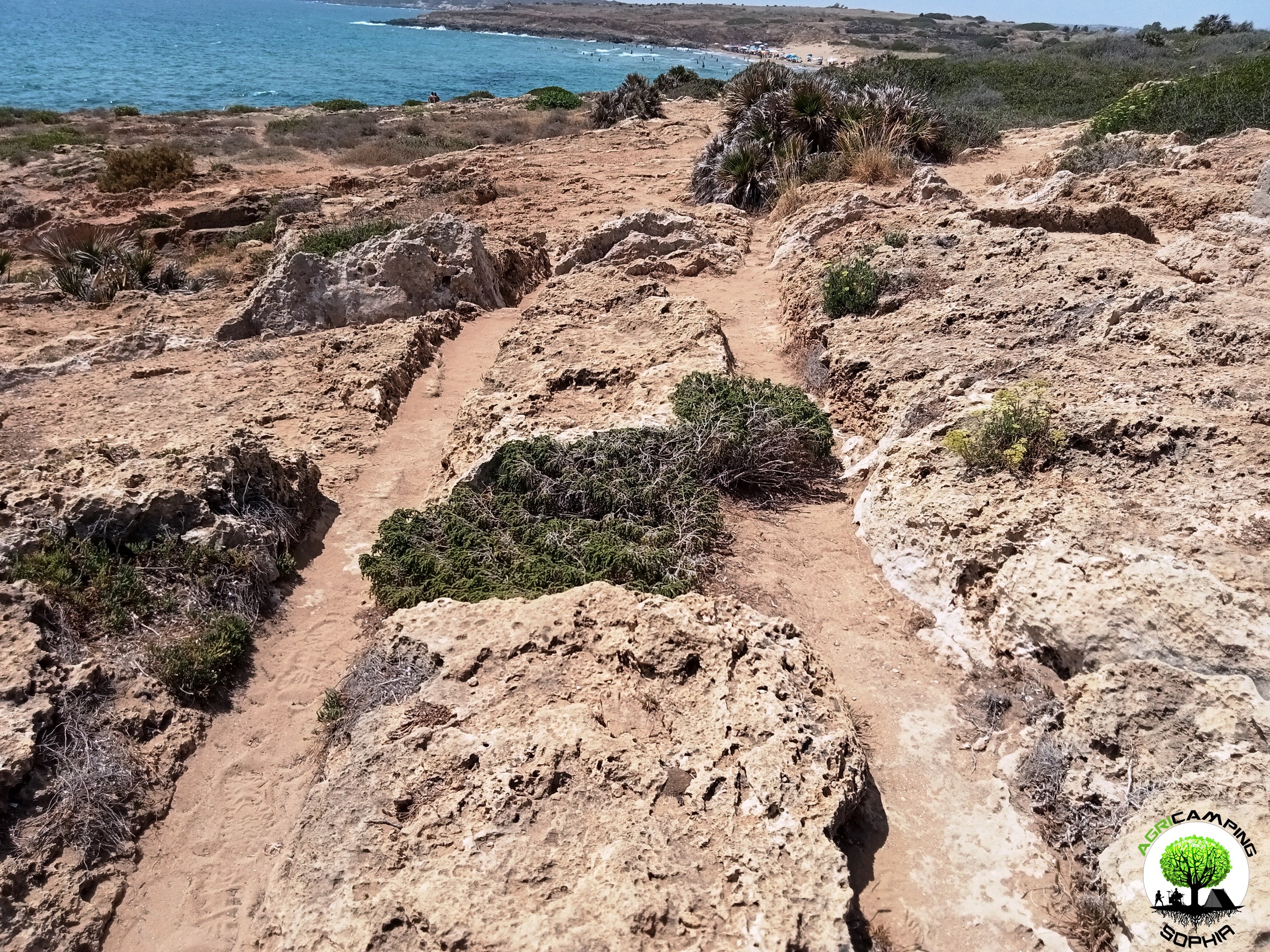 CART RUTS AND A FEW TOO MANY PROJECTIONS
Read also THE POLISHING OF THE CART RUTS
I will skip any preamble, referring to to what has already been written regarding the presence of cart ruts in south-eastern Sicily.Considering the possibility that the cart ruts were gradually dug by the passage of carts pulled by pack animals, for example pairs of oxen, observing certain sections of the cart ruts present in the Granatari Vecchi district, in Rosolini, and in the Pizzuta district, close to the Vendicari Reserve, two questions arise:
1. Why force the animals to pass over rough surfaces and protrusions high, compared to the base of the furrows, even 60-70 centimeters?
2. Why, in the presence of such obstacles, not opt for a detour?
For Mottershead, Pearson and Schaefer such protrusions appeared later, since at the time of the passage of the wagons, a layer of earth covered the rocky bank, thus not making the obstacle...
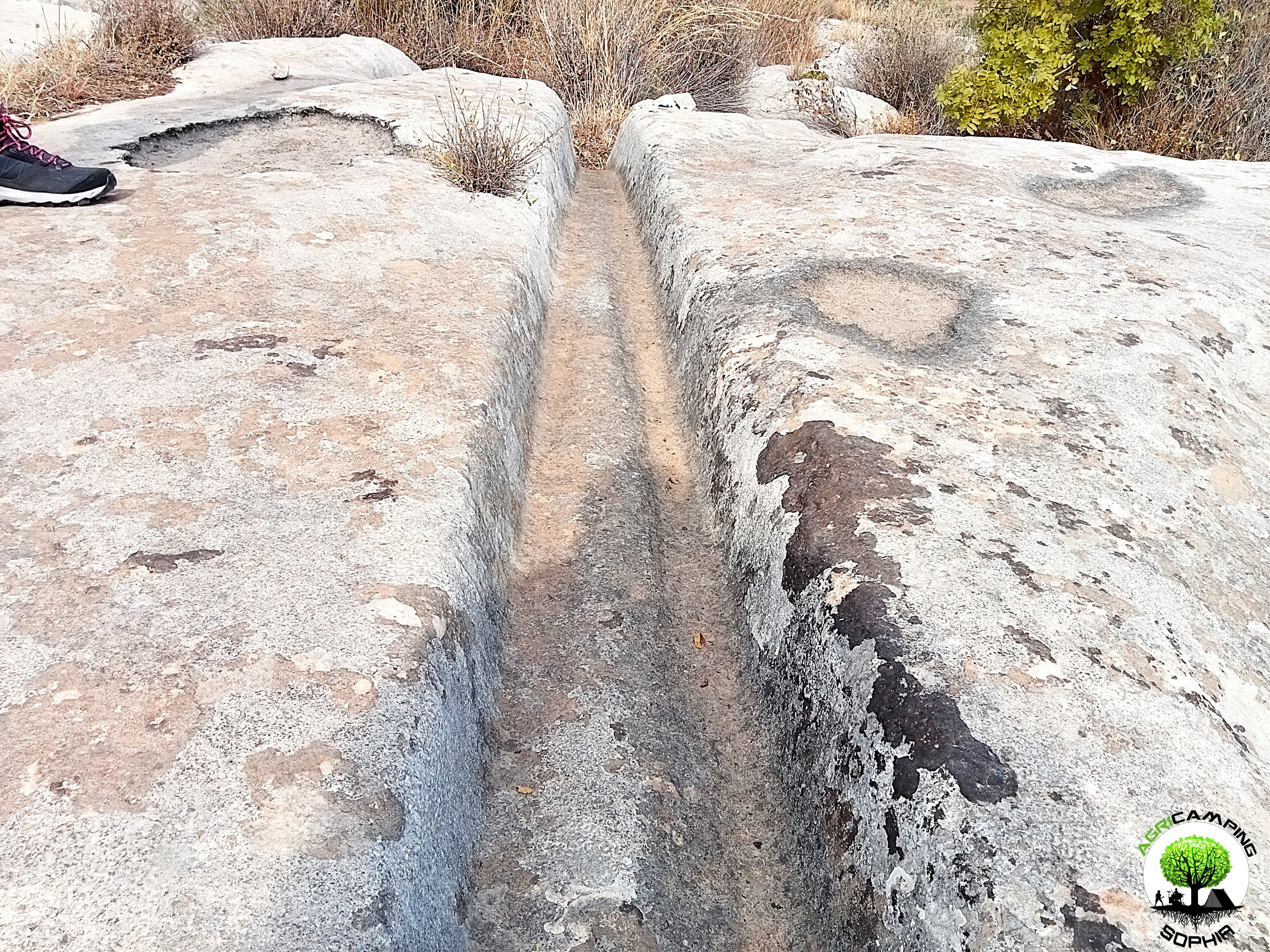 THE POLISHING OF THE CART RUTS
Read also THE PROBLEMATIC EDGES OF THE CART RUTS
I will skip any preamble, referring to to what has already been written regarding the presence of cart ruts in south-eastern Sicily.
To proceed with this comparison I have chosen a probable capital and the corner of a recess present in a block of the northern walls of Eloro that would seem to resemble a pinax, that is, a niche that would have housed a fresco of the heroa, but which a more careful observation refers to a system functional to the grip of the block through a pincer winch. Both elements, like the curt ruts, have remained at the mercy of the elements for millennia, and are therefore subject to comparable wear and tear due to the passage of time. The finishing of the capital should be of a high standard, since it is an architectural element that also has an aesthetic function. The recess, on the other hand, should have...
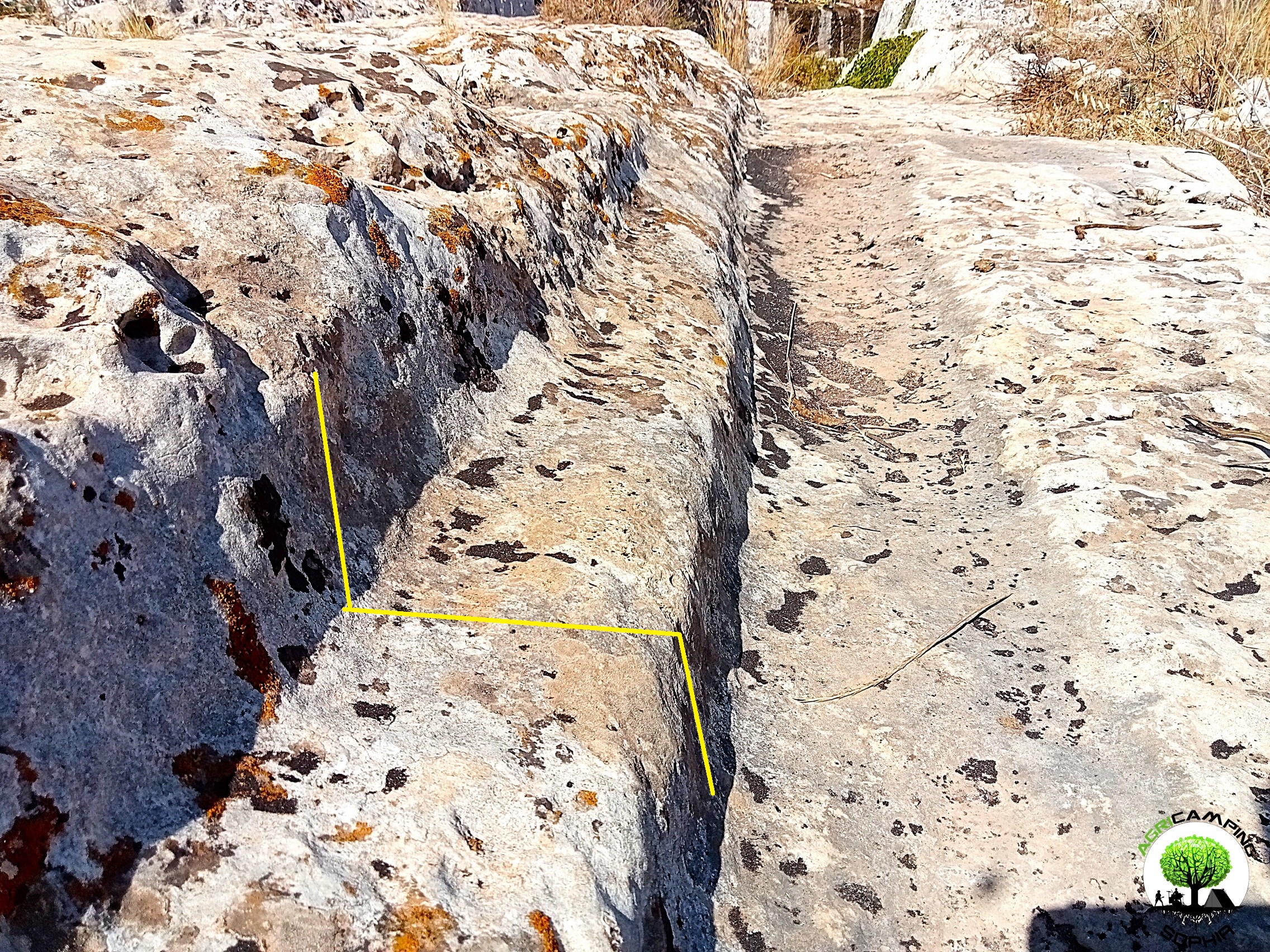 THE PROBLEMATIC EDGES OF THE CART RUTS
I will skip any preamble, referring to to what has already been written regarding the presence of cart ruts in south-eastern Sicily.As can be seen in other sites around the world, in some cart ruts I visited, in particular in the Cugni district in Pachino, in the Granati Vecchi district in Rosolini and in the Targia district in Syracuse, a clear border can be seen, a sort of frame, next to the grooves, more marked externally, barely noticeable internally.
The borders I measured have a width of 14-20 centimeters and a height of 8-10 centimeters.
Not all cart ruts have such frames present or particularly evident, regardless of the degree of wear or degradation. They are found above all in cart ruts with less deep grooves.
As already described in detail, given the presence of furrows with a depth of even 65-70 centimeters, the wheels of a possible vehicle would have had to have a...
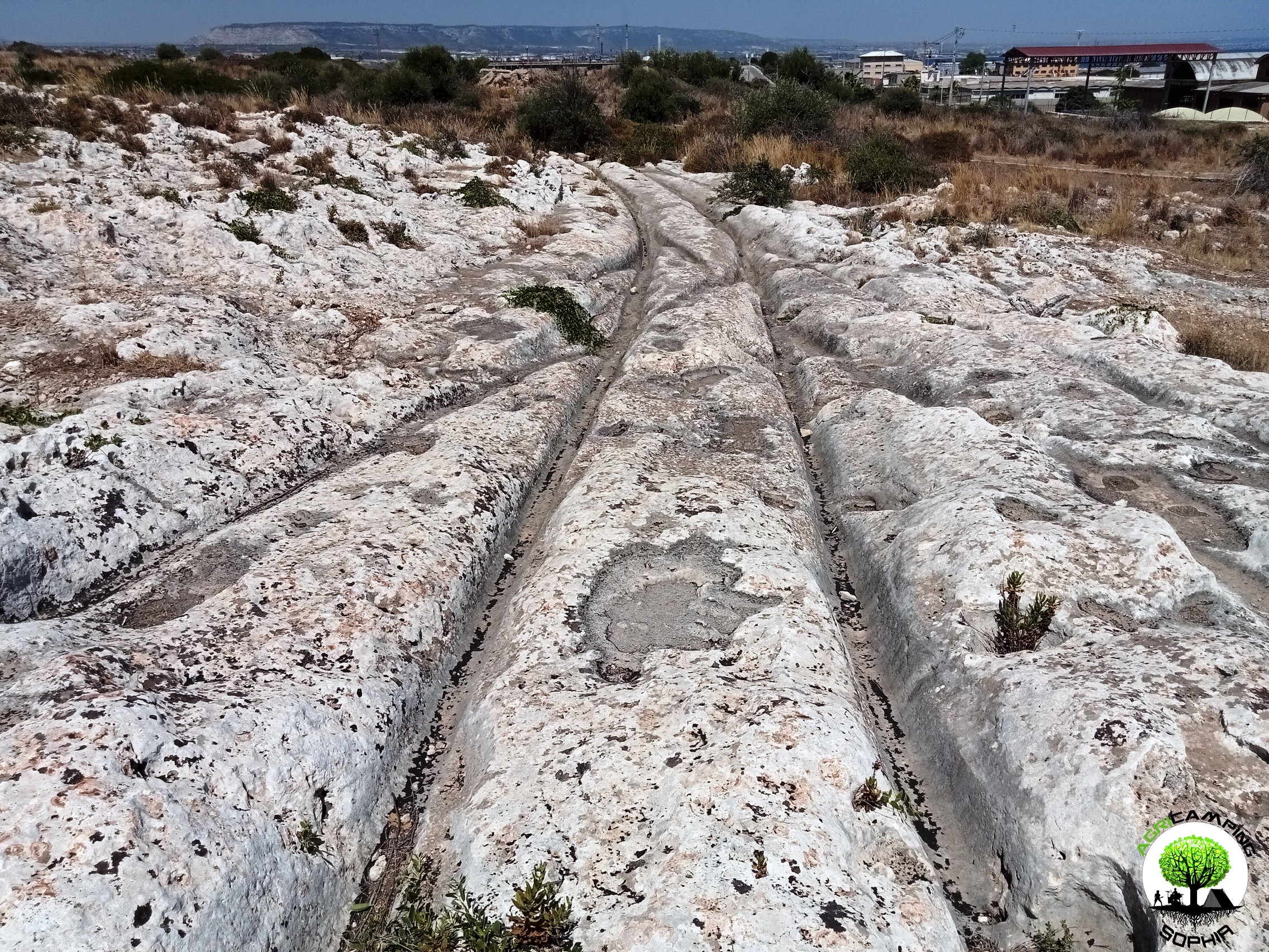 THE PROBLEM OF CART RUTS IN SOUTH-EASTERN SICILY (PART FOUR)
Click here to return to third part
Clapham Junction
As in the Maltese site Misrah Ghar Il-Kbir, also in the Targia and Granatari Vecchi districts the cart ruts intersect and cross each other in a similar way to the track switches in a railway station. The nickname Clapham Junction that was given by David H. Trump to the Maltese site, derives precisely from the similarity with the famous English railway station. For Sagona these are agricultural furrows and water channels, for Mottershead, Pearson and Schaefer these are abandoned paths due to obstacles and wear. Obviously we do not know what the morphology of the Syracuse and Rosolini territory was at times when the cart ruts were traced, but considering the current context, there certainly would have been no agricultural reason to build them, given the presence of fertile land, springs and fresh water courses just a few kilometers...


 DO YOU WANT TO ORGANIZE AN ERASMUS AT AGRICAMPING SOPHIA?
 CART RUTS MODELED ON SOFT ROCK?
 RACK OR HOUSING FOR CLOGS?
 CART RUTS CUT FROM QUARRIES
 CART RUTS AND A FEW TOO MANY PROJECTIONS
 THE POLISHING OF THE CART RUTS
 THE PROBLEMATIC EDGES OF THE CART RUTS
 THE PROBLEM OF CART RUTS IN SOUTH-EASTERN SICILY (PART FOUR)