Click here to return to SECOND PART
Considerations on the theses of Mottershead, Pearson and Schaefer
I find this study extremely interesting, even if I am perplexed by this emphasis on the loss of hardness of the wet rock given that Malta is among the European territories at greatest risk of desertification (as is unfortunately also the south-eastern area of Sicily). We don't know exactly what the climate was like in Malta when the
cart ruts were made, as we don't even know for sure how old they were made. However, it might be understandable to take the
humidity factor as a starting point. n strong consideration, in relation to a territory constantly subject to rainfall, but why would the ancient Maltese have had to intensely travel with loaded carts right after a downpour, with all the inconveniences that for example the mud would have entailed?
The Maltese territory is extremely similar from a morphological point of view to coastal south-eastern Sicily, not by chance from some photos published by the excellent Uwe Schneider on the Maltese
cart ruts, if there were no caption to specify it, it would seem to be in one of the coastal districts between Noto and Portopalo di Capo Passero. However, I have the impression that the explanations of Mottershead, Pearson, Schaefer regarding the Maltese
cart ruts, on the very similar
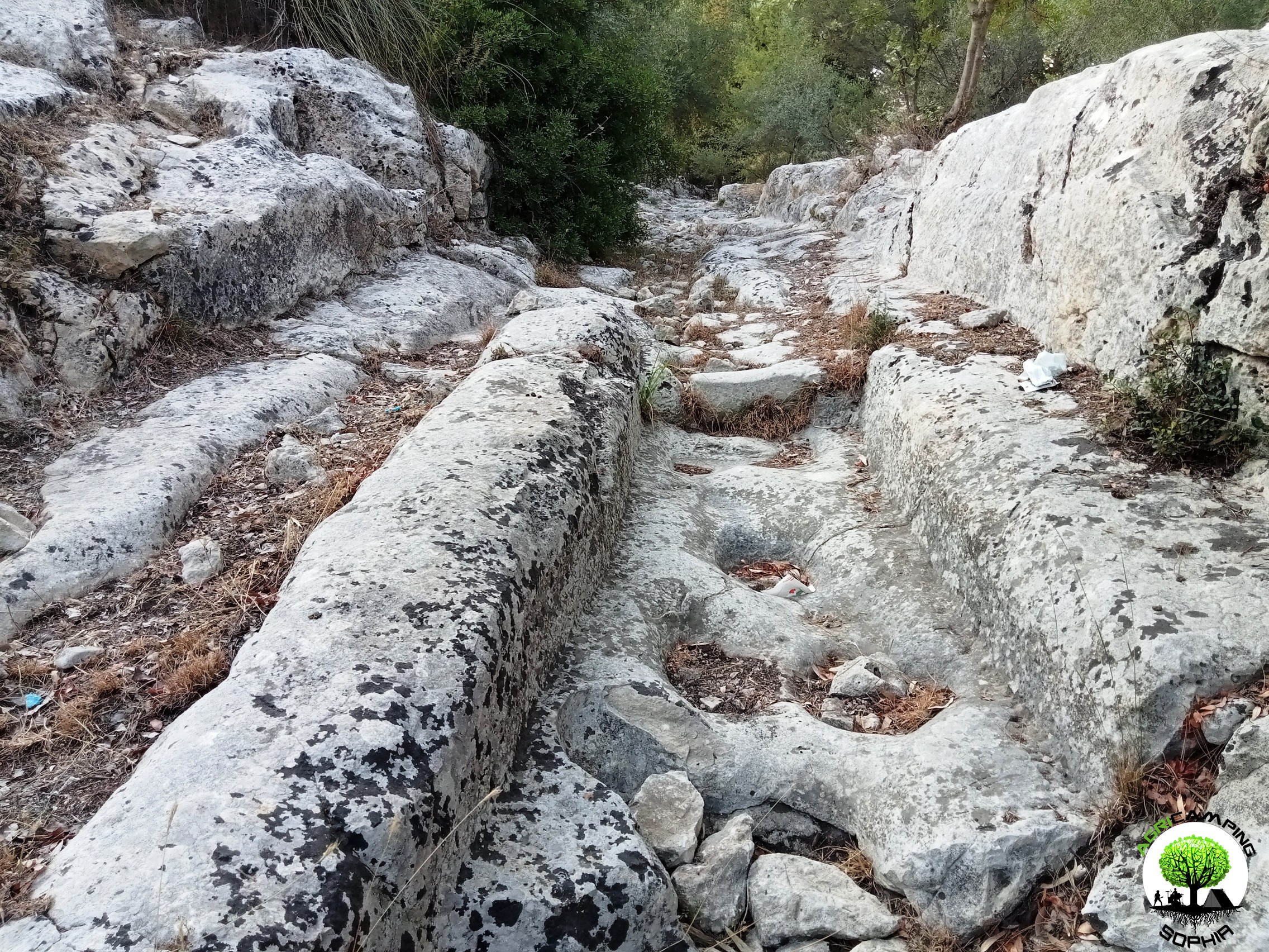
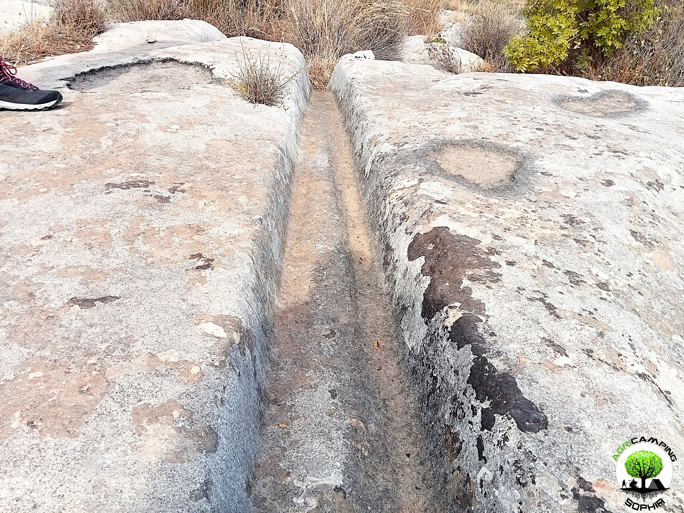
cart ruts of contrada Targia and contrada Granatari Vecchi, are not entirely adequate. For example, regarding the depth of the furrows, I found that a criterion of maintaining the slope is respected, probably to avoid changes, rather than passively finding oneself with furrows 65 centimetres deep due to wear and tear from the many passages. The slope of a given segment is therefore almost always in continuity with that of the previous segment, despite the irregularities of the rock bank.
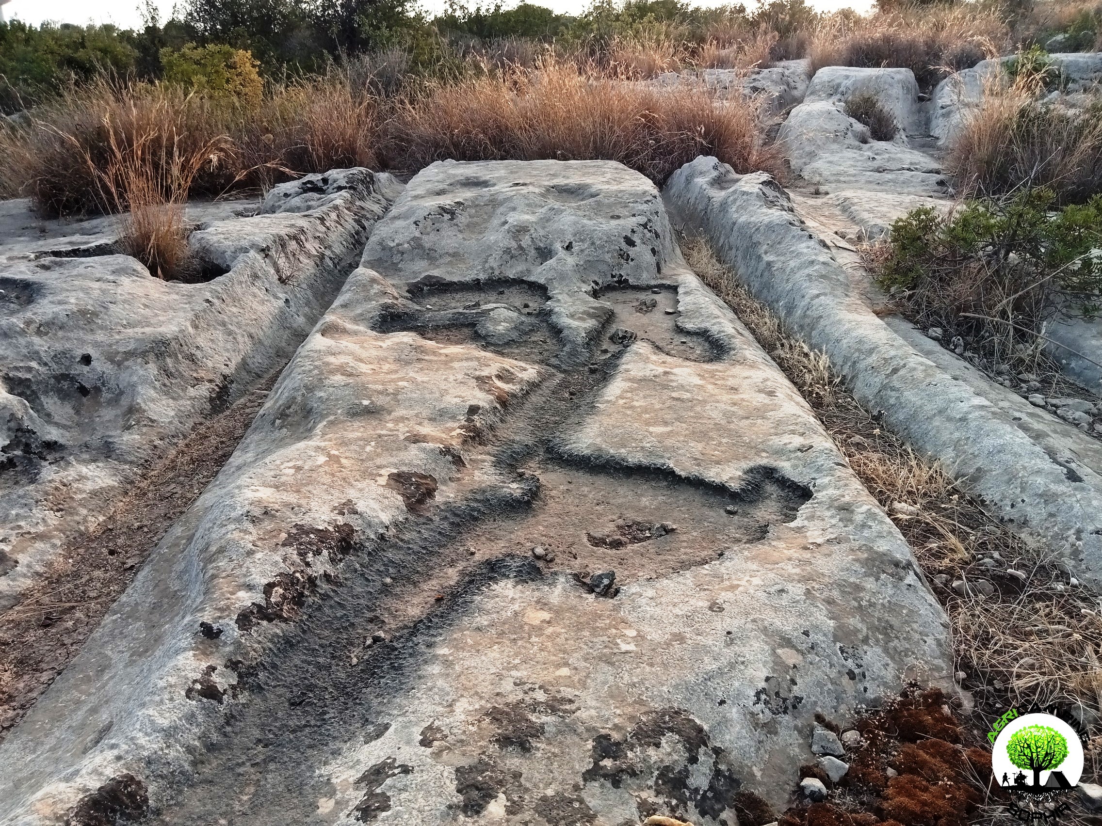
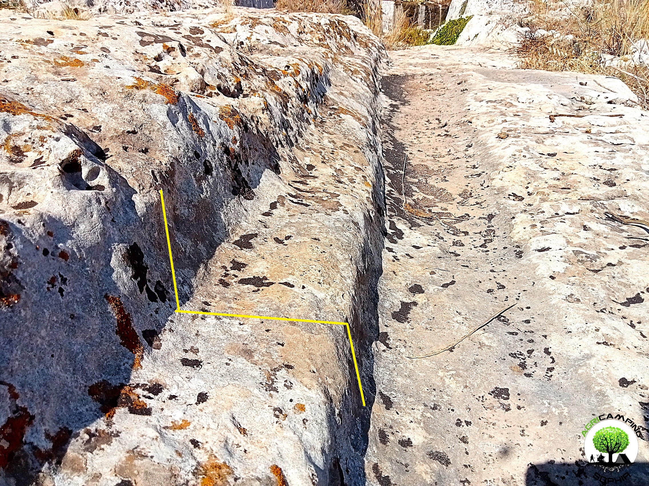
Furthermore, I noted the presence of a sort of frame, border, next to the furrows that can hardly be explained by wear and tear due to the passage of carts, since it is independent of any protrusions at the wheel axles.
I fully share the idea that these furrows cannot be the result of the work of mallets, chisels and picks, but this study seems focused only on demonstrating that those furrows could have been caused by the passage of carts. It would have been interesting to have, for example, an estimate of the number of passages (empty or loaded, dry or wet) that would have been necessary for the carts to produce the Maltese furrows.
Sagona
In 2004, in the Oxford Journal Of Archaeology, Claudia Sagona published an
alternative thesis on the function of the Maltese
cart ruts: unlike Mottershead, Pearson, Schaefer, leveraging the significant degree of drought and aridity of the Maltese archipelago, she hypothesized that they were built for agricultural purposes. The numerous megalithic structures in Malta and Gozo are necessarily the work of a civilization with a complex social structure and important food needs.
Sagona distinguishes the furrows in relation to their shape, for example the shallow and rectangular furrows could, even if she herself raises many doubts about it, date back to the Roman era, therefore a consequence of the passage of Roman carts. Different instead would be the origin and function of the deeper and irregular "U" or "V" shaped furrows, often in multiple groups as at Misrah Ghar Il-Kbir, probably the result of an intense agricultural exploitation of the land. Sagona does not rule out the natural origin of some ruts, which would be due to joints in the parent rock typical of karst topography, however, following Guy Schneider (and unlike Mottershead, Pearson and Schaefer), he believes that some are deliberately cut by hand, with blows of a pickaxe.
Since other populations in the Mediterranean area, contemporary with the culture that built the temples in Malta, used to transport material by hand or by pack animals (directly loaded on their backs), Sagona finds it unlikely that carts were used for transport in the Maltese archipelago. Ancient wheeled vehicles were light and had exclusively military functions. Cart-pulling by animals would have become common only in the Roman period, due to the higher quality of the road network and better harnesses for the animals. With the harnesses available in the Neolithic, animals would not have been able to pull loads of sufficient weight to produce
cart ruts. Furthermore, the depth of the furrows, given the small size of Malta and Gozo, would be incompatible with the potential volume of traffic. According to the author of the study, in particular in Misrah Ghar il-Kbir, some furrows would therefore derive from the processing of the land for agricultural purposes, others would be water channels, spaced between 137 and 141 centimetres apart. For Sagona it is undeniable that to build temples like
Ggantija, that culture knew and skillfully used levers and pulleys. Therefore, even the creation of new arable land, through the application of the same engineering skills, could have been within its reach.
 Considerations on Sagona's theses
It is clear that, given the extreme similarity of the Maltese territory to that of south-eastern Sicily, and considering the strong structural affinity between the Maltese and Sicilian
cart ruts, I relate the study of the Sagona also to the
cart ruts of which I have direct experience. Although for some, in fact, a more recent origin cannot be excluded, caused by the passage of carts, for others I would feel like categorically excluding (therefore in agreement with Mottershead, Pearson and Schaefer) that they could be the fruit of picks and chisels. And since, thanks also to the
work by Uwe Schneider and the
reportage by Massimiliano Caranzano, one has the opportunity to carefully view photos and videos of the Maltese
cart ruts, I wonder what detail could have convinced you that they could have been dug with a pickaxe and chisel.
Furthermore, I cannot identify what fresh water the ancient Maltese could have channeled, if today the fresh water available in Malta is almost all obtained from the desalination of sea water, being substantially devoid of water courses or sources. To give credence to this thesis, I would have expected to find, near Misrah Ghar Il-Kbir, a system for accumulating rainwater to be drained, when needed, along the network of furrows. Obviously the argument that Sagona makes is more complex than the summary I have made, also postulating the use of algae as fertilizer, but the essence is that such a system, in order to function, would still require the availability of fresh water.
With respect to the majority of
cart ruts I am certainly not a supporter of the thesis, although plausible in certain cases, according to which they were caused by the passage of carts, however another point of the study of Sagona that leaves me a bit perplexed is the reference to the culture that built the temples, as also creator of the alleged agricultural furrows, excluding however the use of transport carts: the 50-ton megaliths of
Ggantija, if we exclude the use of towed vehicles or in any case powered by animal power, how would they have moved them?
Characteristics of cart ruts in south-eastern Sicily
I had way to observe in the field, with attention, the
cart ruts in the Targia district, in Syracuse; in the Vendicari Reserve, between the Pizzuta and Maccari districts; in the Granatari Vecchi district, in Rosolini; in the Cugni district, in Pachino. I have also found traces of them in other areas, including Noto Antica, the Castelluccio di Noto district and near Cavagrande del Cassibile, but I am quite uncertain whether some of them can be properly called
cart ruts, so for the moment I have chosen not to take them into consideration as a primary reference.
The impression is that there are different types of
cart ruts, with small differences regarding the width of the track and the shape of the groove. However, the fact that many are extremely damaged and worn means that it cannot be ruled out that these are structures that the course of time (and frequent use?) has modified so much that they now appear substantially different from their original shape.
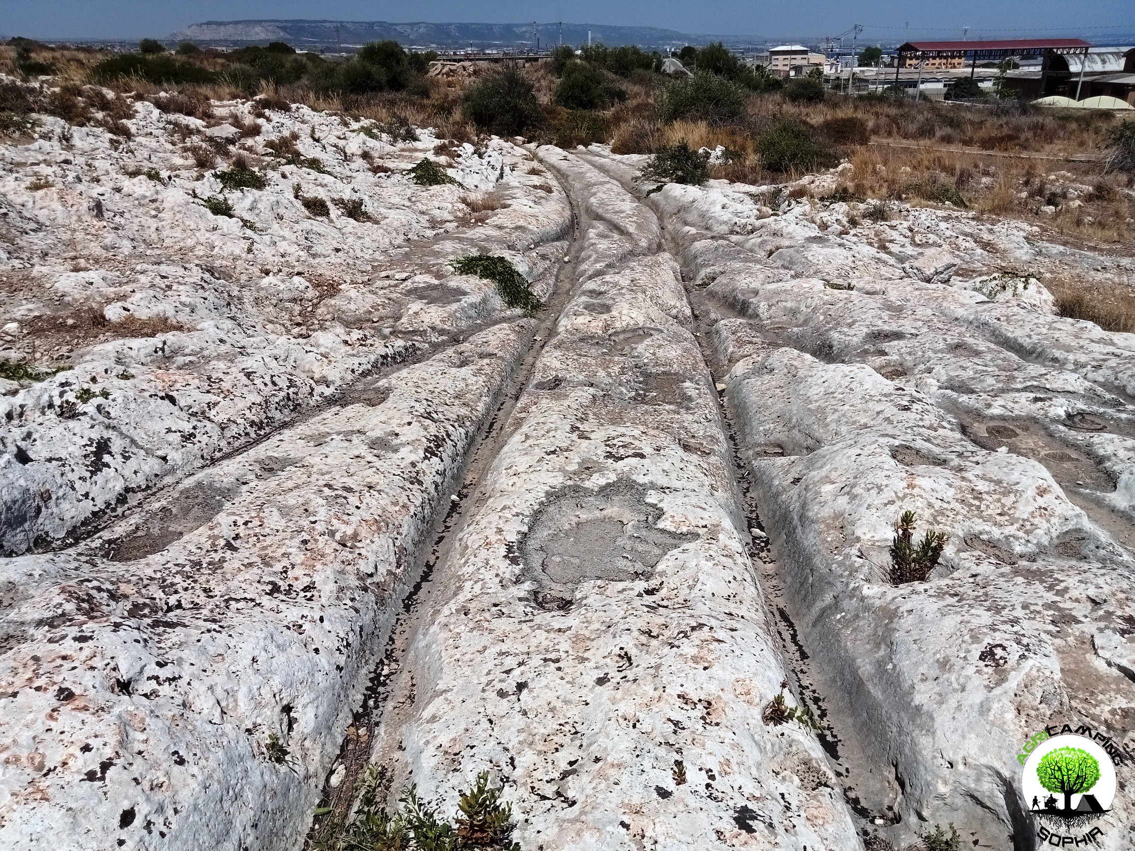
The internal width of the roadway, i.e. from the inside of the grooves to the inside of the grooves, measures on average between 110 and 130 centimetres, the width of the grooves varies between 15 and 40 centimetres and their average depth measures between 15 and 30 centimetres, with peaks of 65-70 centimetres (due to protrusions of the rock, in order to maintain a linear slope of the groove). Some grooves, with a clear “V” profile, have a width at the base, in the deepest part, of 10-12 centimetres. Next to the grooves there is generally a sort of border, a frame, 8-10 centimetres high and 14-15 centimetres wide. In the presence of steep slopes there are central holes, slightly off-centre, with an average diameter of 30 centimetres, an average depth of 20 centimetres and 40-50 centimetres apart.
At the bottom of the furrows, in particular in the most defined and best preserved
cart ruts (in the Granatari Vecchi district and in the Targia district), a darker colouring of the rock can be found which, as highlighted by some extraction templates of blocks that cut some
cart ruts in Targia, penetrates inside the rock for 5-10 centimetres, as if it had been burnt, subjected to strong heat (a consequence of significant friction?)
Operating with the same logical categories as Mottershead, Pearson and Schaefer, taking into consideration the measurements of the best preserved
cart ruts, a vehicle suitable for travelling along them should have had a a length of 130 centimetres, a diameter of the wheels, evidently iron-shod, of at least 145 centimetres and a width of 8 centimetres. That is, measurements similar to the chariot theorised by the three scholars. Only a few
cart ruts would have been compatible with both the Roman cart of Minero and the reconstructions made in Selinunte and in the Valley of the Temples.
As already written, I exclude that the majority of the
cart ruts personally examined were made with pickaxe or chisel, since the accuracy of the smoothing is such that it has no correspondence with the authentically Greek structures present in the area, in which the workmanship with a pickaxe or chisel is evident.
If one were not certain that it was native limestone, especially in Granatari Vecchi, it would seem to be dealing with a pouring of very liquid cement or, in any case, with rock that at the time of processing was not entirely solid, as if it were a sort of lava.
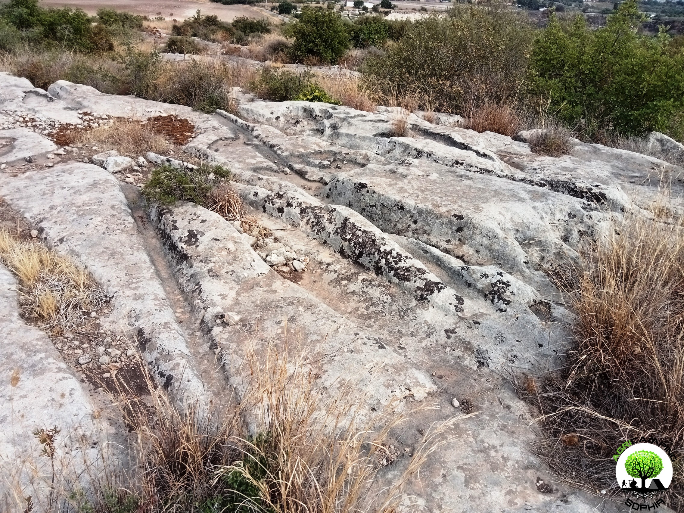 Latomie and cart ruts
The orthodox theory, i.e. the
ipse dixit on Sicilian
cart ruts, is that they are Greek
carraie whose grooves are the indirect product of the numerous passages of carts, pulled by animals, loaded with blocks of calcarenite or sandstone extracted from the quarries, locally also called
latomie.
The problem is that near many important
latomie, such as the partially underwater ones of Marzamemi, there is no trace of
cart ruts.
Certainly in Roman times, and probably also in Greek times,
the sea level was at least one meter lower than today. Therefore, it is obvious that the
latomie of Marzamemi were exploited when they had not yet been submerged by the sea. Given the evident absence of
cart ruts along the cliff in front of these
latomie, it can be assumed that the extracted blocks were transported by sea. Any boats, compared to what the current morphology of the territory suggests, would have been found at least 130 meters away from the first quarries: would the extracted blocks have had to be transported on these boats in some way? Why are there even the smallest traces of carvings in the rock and why have all the cartwheel tracks been erased?
Even in the Pizzuta area there are quarries of a certain size 120-150 meters from the coast and the first evident
cart ruts are found close to the sea: shouldn't there be traces of
cart ruts starting from where the blocks were extracted?
By the same logic, shouldn't the presence of a significant quantity of large blocks, for example in Megara Iblea or near the northern walls of Eloro, presuppose the presence of
cart ruts? Given that, as we have seen, the Siceliots tended to optimize work processes, extracting building material close to construction sites, if the
cart ruts were actually the product of the passage of carts, shouldn't we expect to find them in large quantities especially close to the most important works? Conversely, why is there no trace of structures in the Cugni district, in Pachino, or in the Granatari Vecchi district, in Rosolini, that could justify the presence of the
carraie?
As also noted by
David H. Trump in relation to his studies on the Maltese
cart ruts and as already briefly mentioned, some
cart ruts are interrupted by
latomie but re-emerge exactly in the point where they would have been found if there had not been such quarries: the impression is that it was the
latomie that cut the
cart ruts and therefore that the former were chronologically later than the second ones. I also found the presence of extraction templates right in the middle of some
cart ruts, with one side falling exactly along a groove, as if this had been substantially exploited to shorten the extraction work. David H. Trump wrote in 2002, regarding the Maltese ruts, that "there are some cases where later quarrymen exploited the ruts to facilitate the extraction of stone. Here it is clear that the ruts came first and the extraction came later, probably much later".
If the
cart ruts had been contemporary with the
latomie, and therefore somehow connected to them or even in function of them, what sense would there have been in fundamentally ruining or cutting them off?
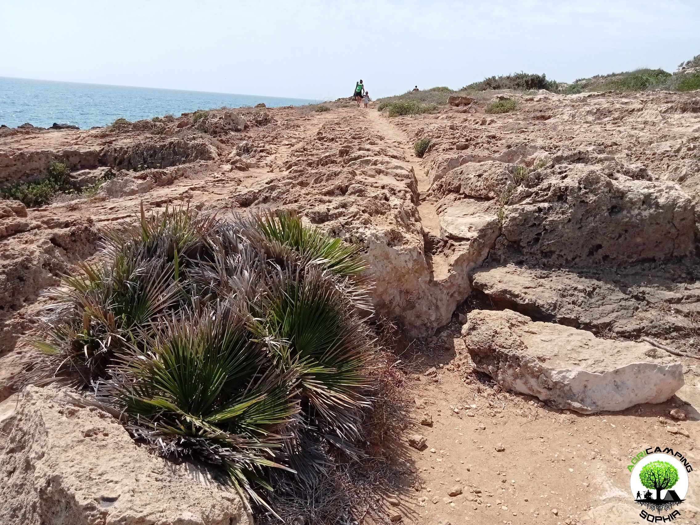 Avoiding obstacles
At the sites I have visited, there are rock protrusions up to 70 centimetres high from the base of the the furrow (which recalls the 65 centimetres of the Mottershead, Pearson and Schaefer surveys): even if the axle of the vehicle had been high enough to pass over it, for what arcane reason would it not have been more practical, less problematic, to deviate those protrusions, to pass over them laterally, instead of forcing any pack animals to climb over them? Moreover, if the vehicle is towed by animals, why not choose softer routes, perhaps on beaten earth, rather than stressing the wheels and hooves on the hardness and roughness of the rock? From the descriptions of Vitruvius himself, a Greco-Roman mentality emerges, aimed at practicality, at the search for technical systems to make work easier, to rationalize it, a
modus operandi not dissimilar to ours… In this case, I would prefer to embrace the thesis of Mottershead, Pearson and Schaefer on the presence of a layer of earth that hid 70 centimeters of rock outcrop, rather than hypothesize the lack of foresight of the Siceliots…
However, it would remain to be explained how it would have been possible to notice a problematic rock layer only after having consumed 70 centimeters… Rock and earth do not have the same density and some anomalous jolt at each passage would have been perceived…
Greek and Roman roads
In relation to the thesis according to which the Sicilian
cart ruts were the direct work of the Greeks or Romans, therefore dug with pickaxe, chisel and mallet, it must first be considered that the Greek
polies, almost always in conflict with each other, joined together in military alliances only to face enemies that individually they would not have been able to face. The
Greek identity, culturally in opposition to the rest of the world they knew, populated by the
barbarians (among whom, initially, were also included the Romans ...), was not at all intended by them as a political unit. It was forcibly forced to be so, first with Philip II of Macedonia and his son Alexander the Great, then, as a province of the Roman Empire. For this reason, unlike the Romans, they did not have much interest in building roads outside their own
polis (apart from a few and circumstantial exceptions), which would still mostly have been
paved, as they were used to doing. Furthermore, the geographical context, namely the predominantly mountainous territory of Greece, discouraged, given the difficulties they would have encountered, any ambition to build
extra-polis roads.
The Romans, on the other hand, managed to build a thousand-year-old Empire also thanks to their excellent road network. Their expertise in building roads, which were, among other things, far superior to the Greek ones, was such that it is not clear why they would have had to go and trace furrows in Malta (a consideration also considered by Sagona).
The authentically Greek and Roman roads (for example in the
Marche, near
Corinto or
Pompeii) are all paved and some also have grooves. Some of these were dug specifically as drainage systems or to direct carts to certain passage points, others were actually created by wear of the stone, so much so that at a at a certain point they were forced to build the carts by standardizing the gauge (of about 140 centimeters), otherwise the carts with a different gauge would have had difficulty in traveling on those tracks: however these ruts have very different characteristics from the typical ruts of the
cart ruts (for example with regard to depth, shape and, obviously, context).
Click here to read the FOURTH PART




 DO YOU WANT TO ORGANIZE AN ERASMUS AT AGRICAMPING SOPHIA?
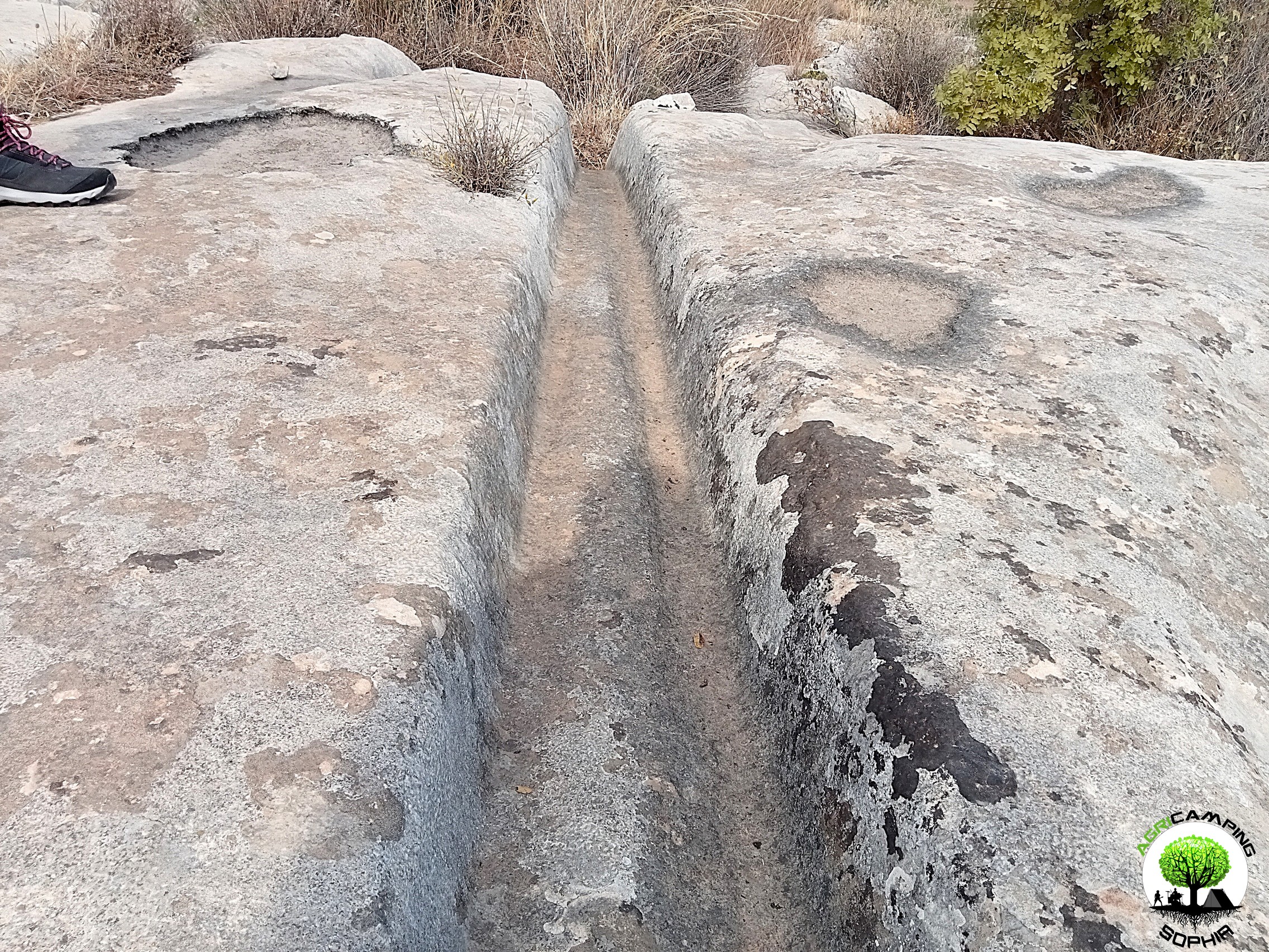 CART RUTS MODELED ON SOFT ROCK?
 RACK OR HOUSING FOR CLOGS?
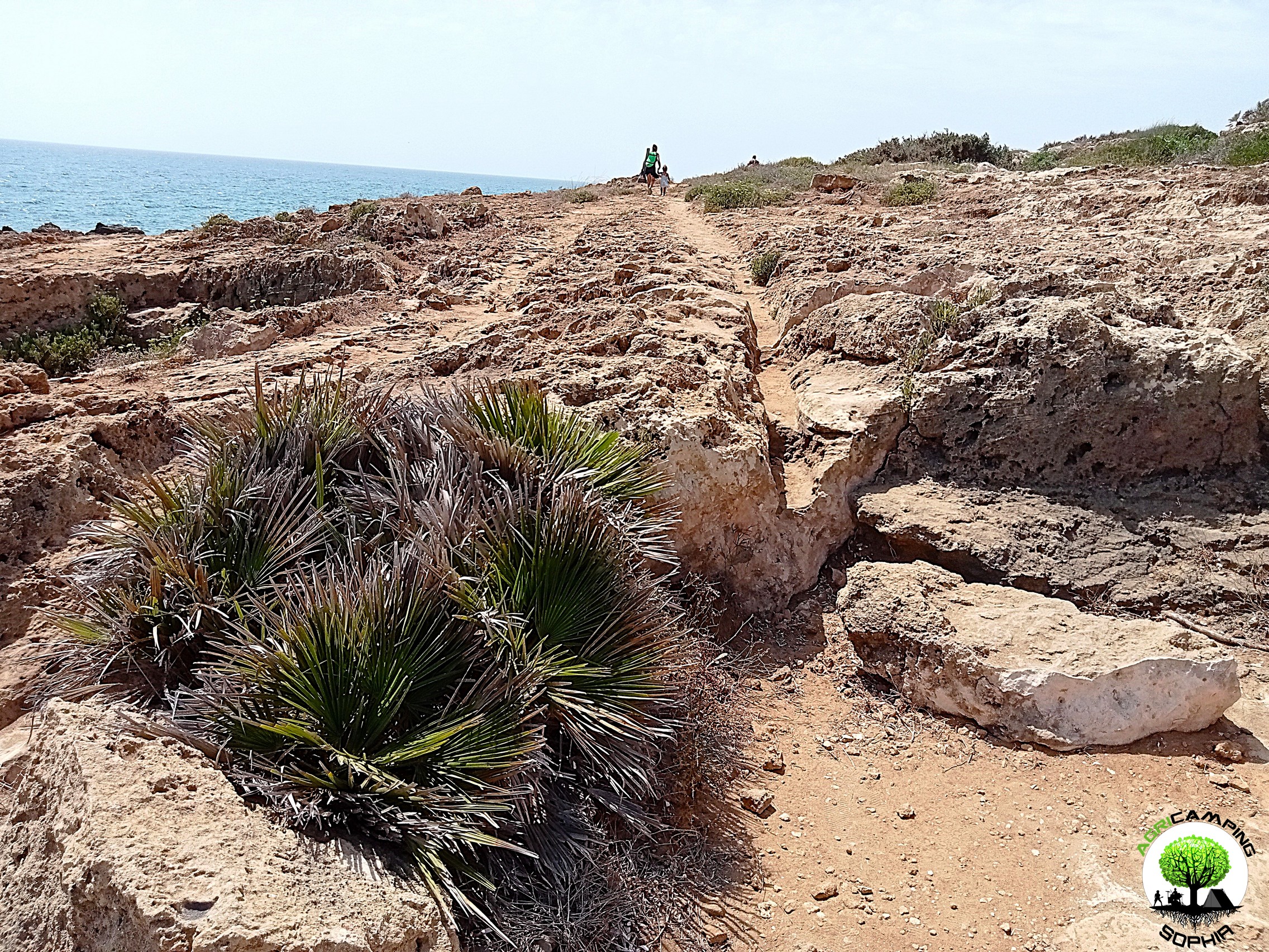 CART RUTS CUT FROM QUARRIES
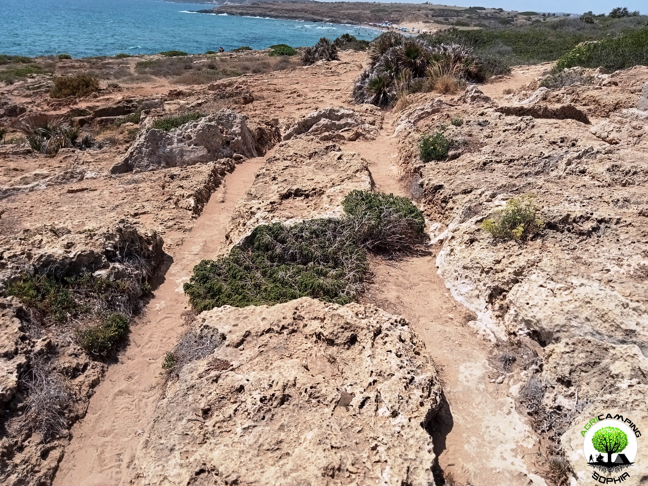 CART RUTS AND A FEW TOO MANY PROJECTIONS
 THE POLISHING OF THE CART RUTS
 THE PROBLEMATIC EDGES OF THE CART RUTS
 THE PROBLEM OF CART RUTS IN SOUTH-EASTERN SICILY (PART FOUR)