TORRE SCIBINI: SYMBOL OF PACHINO

Photo Source: Antonino Rampulla
Among the most important monuments of Pachino, much to be stylized in the heraldic coat of arms of the city, the Scibini tower (or Xibini, because in the past the imperfect writing of the terms beginning with the letters S and C, often traced too close to each other, gave rise to the error of transcription in X)
lying forgotten on the edge of a trazzera campaign, a couple of kilometers from the town. Torre Scibini, which suffered copious damage due to the earthquake that razed the Noto in 1693, was timidly but effectively renovated only in 1994 by the Superintendency of Syracuse. Since then, its best exploitation has been achieved by caper plants which flourish at its base ...

Acquired in 1395, during the Spanish domination of Sicily, by the baron Mainitto Xurtino (or Sortino) of Palazzolo (Acreide), the fiefdom Scibini was characterized by a particularly fertile hill territory. The tower was built by its descendant Antonino in 1494 (or 1493) in order to
supervise the cultivation of the fief to prevent thefts and raids by local rural communities. Before the recent study by Salvatore Cultrera and Guido Rabito, widespread opinion was that Torre Scibini was part of the system of watch towers to defend the coast of south-eastern Sicily from the raids of Barbary pirates (Maghreb). However, even through empirical evidence, it was clear that Torre Scibini was in a
poor vantage point of the coast (unlike, for example, the nearby Torre Fano): from the highest point of the tower you can only see a small portion of the Morghella beach.

Torre Scibini, with a square base, is about ten meters high. The ground floor, which could only be entered from the upper floor (ie the Gurdian housing), probably served as galley. The tower could only be accessed from the outside, by a wooden staircase that was then withdrawn inside. On the main façade of the tower is the emblem of the family Xurtino (a shield and three slanted bars, framed by a rhomboidal bas-relief) and an inscription in Latin.
The inscription was damaged, as well as by the physiological wear and tear of the weather and the bad weather, also by the shootings of the hunters who in the IXX and in the XX century used it as a target ... Blissful ignorance! To complicate the translation there are also the typical abbreviations of the period, which involved, for Cultrera and Rabito, a non-simple comparison with tombstones of the same period.
The work of Cultrera and Rabito also refutes the consolidated opinion that this inscription was a tender to hire militias because, not only, there is no clear trace in the text (which would simply describe the reason for the construction of the tower), but above all because, more than ten meters high, it would have been impossible to read. I would also like to add a personal reflection: in an era characterized by a very low popular schooling, especially in a rural area, where the stone inscriptions were handcrafted and laboriously done with hammer and chisel,
what sense would had an enrollment notice enforced (therefore temporally determined), among other things in classical Latin? For completeness of information, please also mention
the radically different opinion on the genesis of the tower and the discordant translation of the inscription by
by Giuseppe Mario Lucchese.

Around the tower, which is therefore very likely that it was never a military garrison, nor a sighting and signaling of the Saracen raids, there were stalls and tenements (of which there are few traces left) to the dwelling of the farmers who worked the fields of the Scibini fiefdom. Given the discovery less than a hundred meters from the tower of a
Arabian-style aqueduct, it is not possible to exclude the pre-existence on site of a similar Arab structure and the hypothesis that Torre Scibini had been built on the its ruins.
In 1563 the baron Francesco Starrabba of Piazza (Armerina), ancestor of the founding Starrabba of Pachino in 1760, marrying Ippolita Sortino (heir of the Xurtino family), acquired the fiefdom Scibini, thus binding inextricably the history of the tower to the
history of Pachino.
Text Source: Antonino Rampulla
ARCHIVE NEWS
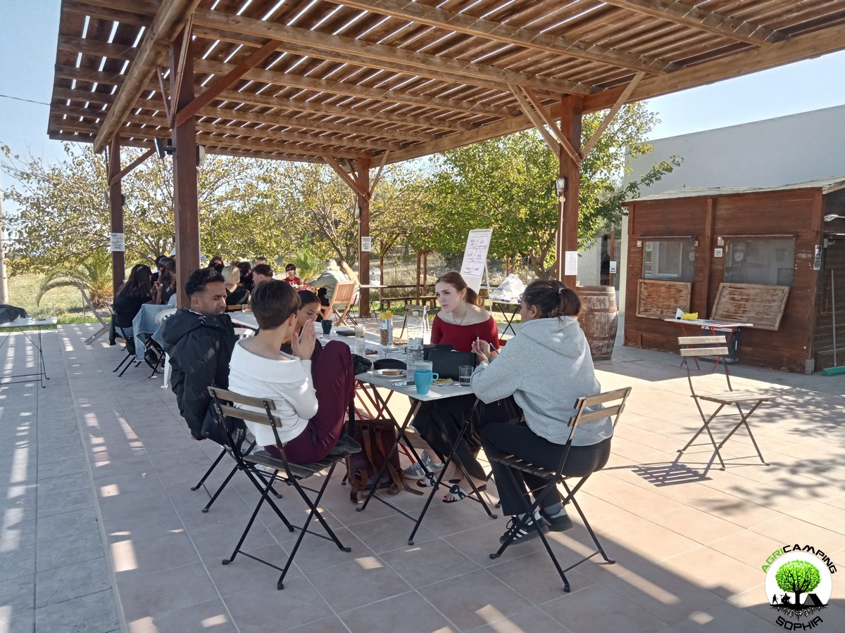 DO YOU WANT TO ORGANIZE AN ERASMUS AT AGRICAMPING SOPHIA?
WHAT IS AGRICAMPING SOPHIA?
It is a campsite with tent pitches, glamping tents, mobile homes and bungalows
WHERE IS IT?
In Italy, in Sicily, near Syracuse, in Pachino: 36.736883, 15.095610
HOW TO CONTACT US?
info@agricampingsophia.it
(SPEAK ENGLISH) +39 3473079242 – (ONLY SPEAK ITALIAN) +39 3452396095
WHAT DO WE OFFER?
We offer hospitality and catering for Erasmus projects
FOR HOW MANY PEOPLE?
We can have 4-7 single beds in the Socrate Bungalow, 6-10 single beds in the Platone Mobile Homes, 4-6 single beds in the Aristotele Mobile Homes, 4 single beds in the Iblone Mobile Homes, 4 single beds in the single beds in the Empedocle Glamping Tents. In total we therefore have 18 comfortable single places or 31 single places with a fair spirit of adaptation.
IN WHICH PERIOD CAN AGRICAMPING SOPHIA BE AVAILABLE?
The most suitable periods to use our services...
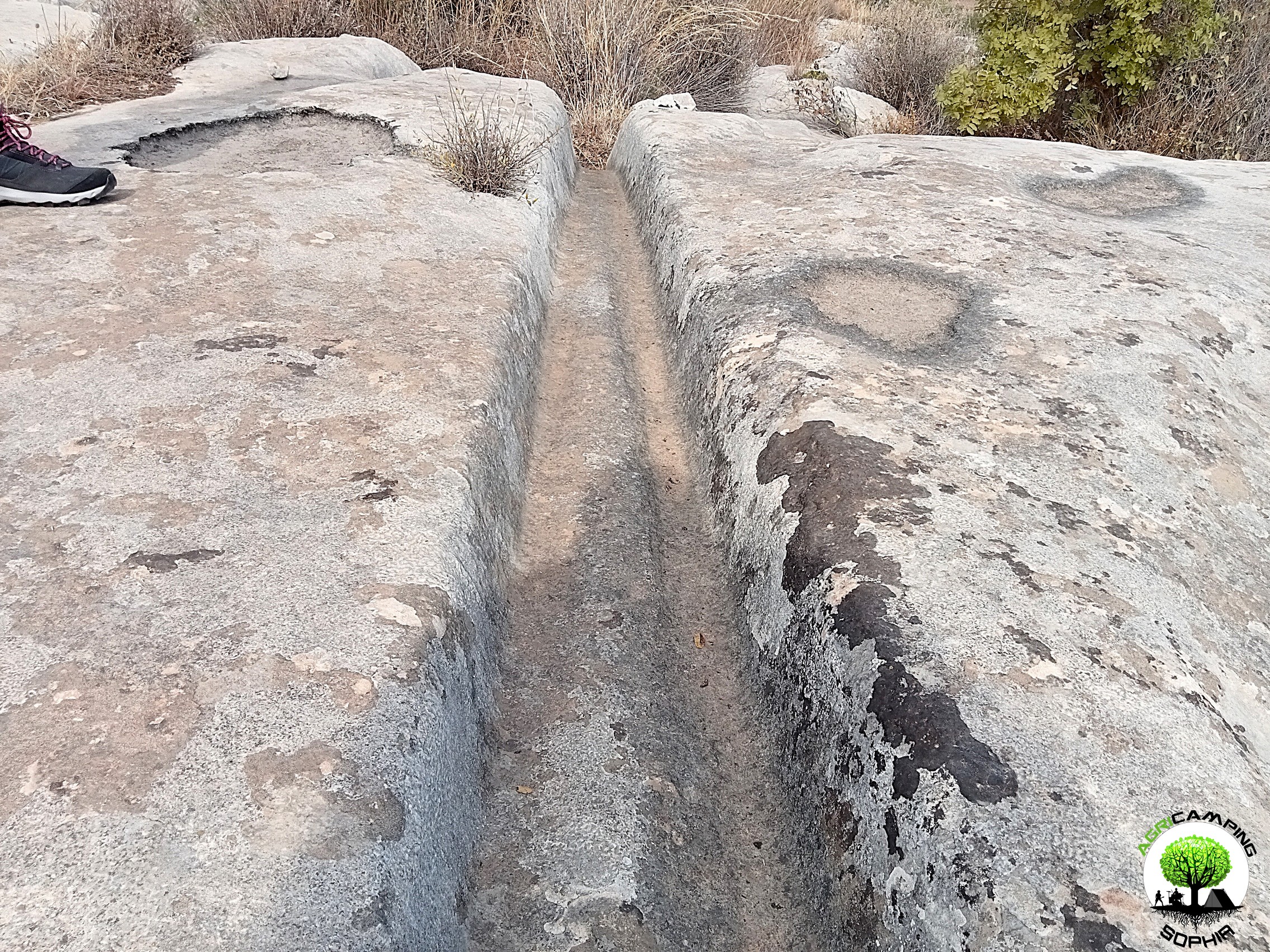 CART RUTS MODELED ON SOFT ROCK?
Read also RACK OR HOUSING FOR CLOGS?
Some cart ruts from the Targia district, in Syracuse, and most of the cart ruts from Granatari Vecchi, in Rosolini, give the impression of having been impressed, modelled, on a rock that was originally viscous, not entirely solid. As absurd as this hypothesis may seem, especially in Granatari Vecchi, the softness of the shapes and the at least anomalous uniformity of the rock bank, as if it were a concrete casting, which hosts the cart ruts, is unicum compared to the lithic context in the area.
In Targia this phenomenon is less impressive but if we consider the cart ruts essentially cart tracks, therefore furrowed roads indirectly resulting from the repeated passage of carts along the same route, we do not understand why such uniformity and smoothness is present, in the majority of cases, also on the parts not affected by the passage of the...
 RACK OR HOUSING FOR CLOGS?
Read also CART RUTS CUT FROM QUARRIES
In the presence of slopes, even slight ones, in some cart ruts in the Targia district, in Syracuse, central holes are found with a diameter of between 30 and 50 centimeters and a depth of 15-20 centimeters, spaced about 50 centimeters apart. Neither the position (they are not exactly in the center of the cart ruts and perfectly aligned with each other), nor the shape appear perfectly regular: either the passage of time and any wear have profoundly modified their original shape or, simply, they have never had a systematic regularity. However, the offset in position between one hole and another is never completely “off-axis”: there is always a portion about twenty centimeters wide that coincides with the same portion of the previous and subsequent hole. The best preserved and most defined holes are found in the cart ruts usually called Scala...
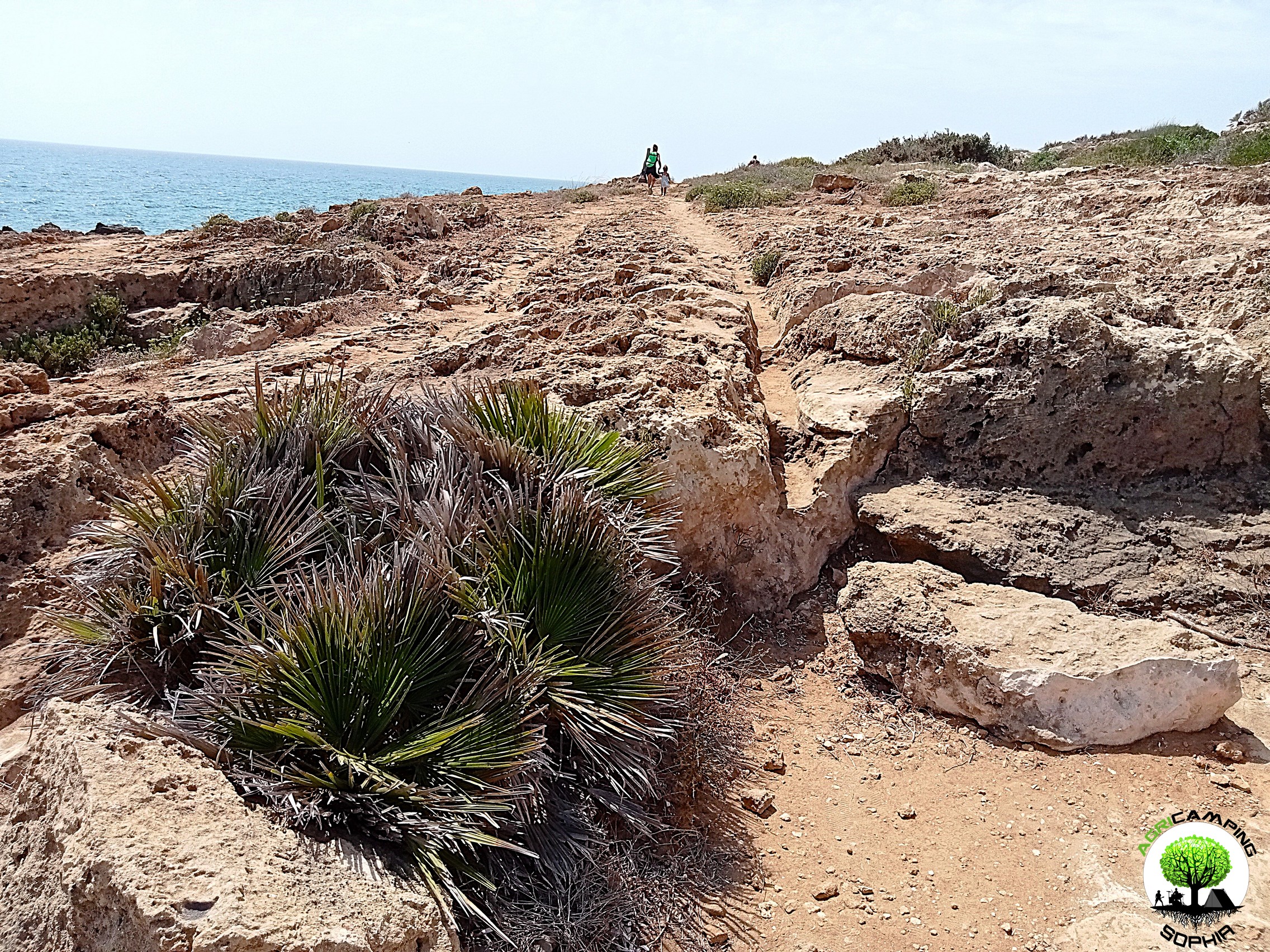 CART RUTS CUT FROM QUARRIES
Back to CART RUTS AND A FEW TOO MANY PROJECTIONS
I will skip any preamble, referring to what has already been written regarding the presence of cart ruts in south-eastern Sicily.
The easy academic tendency has been, in most cases concerning cart ruts, to consider them in terms of the latomie, or quarries, with which very often (for example in the cases of the Targia or Pizzuta districts) they share the same territory.
According to this theory, the carraie would have been indirectly created due to the wear of the rock at each passage of carts or sleds loaded with extracted stone blocks. I will not repeat the arguments presented so far in order to demonstrate that this is a theory that has little solid foundations on an in-depth analysis of the cart ruts. However, I will add a piece by demonstrating the implausibility of a connection between them in both chronological and functional...
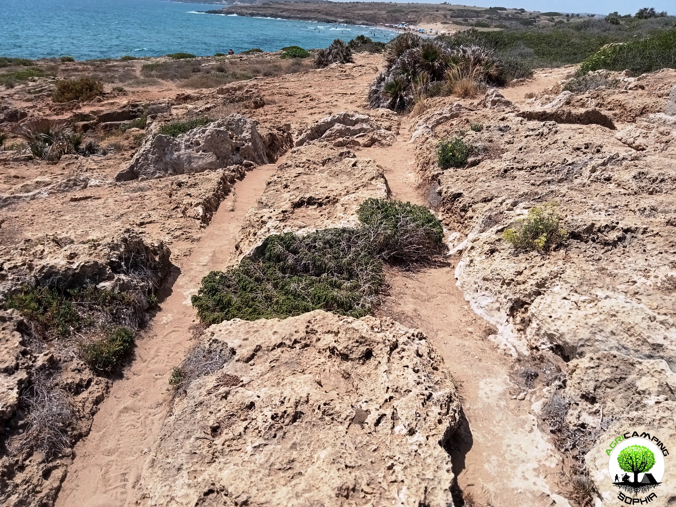 CART RUTS AND A FEW TOO MANY PROJECTIONS
Read also THE POLISHING OF THE CART RUTS
I will skip any preamble, referring to to what has already been written regarding the presence of cart ruts in south-eastern Sicily.Considering the possibility that the cart ruts were gradually dug by the passage of carts pulled by pack animals, for example pairs of oxen, observing certain sections of the cart ruts present in the Granatari Vecchi district, in Rosolini, and in the Pizzuta district, close to the Vendicari Reserve, two questions arise:
1. Why force the animals to pass over rough surfaces and protrusions high, compared to the base of the furrows, even 60-70 centimeters?
2. Why, in the presence of such obstacles, not opt for a detour?
For Mottershead, Pearson and Schaefer such protrusions appeared later, since at the time of the passage of the wagons, a layer of earth covered the rocky bank, thus not making the obstacle...
 THE POLISHING OF THE CART RUTS
Read also THE PROBLEMATIC EDGES OF THE CART RUTS
I will skip any preamble, referring to to what has already been written regarding the presence of cart ruts in south-eastern Sicily.
To proceed with this comparison I have chosen a probable capital and the corner of a recess present in a block of the northern walls of Eloro that would seem to resemble a pinax, that is, a niche that would have housed a fresco of the heroa, but which a more careful observation refers to a system functional to the grip of the block through a pincer winch. Both elements, like the curt ruts, have remained at the mercy of the elements for millennia, and are therefore subject to comparable wear and tear due to the passage of time. The finishing of the capital should be of a high standard, since it is an architectural element that also has an aesthetic function. The recess, on the other hand, should have...
 THE PROBLEMATIC EDGES OF THE CART RUTS
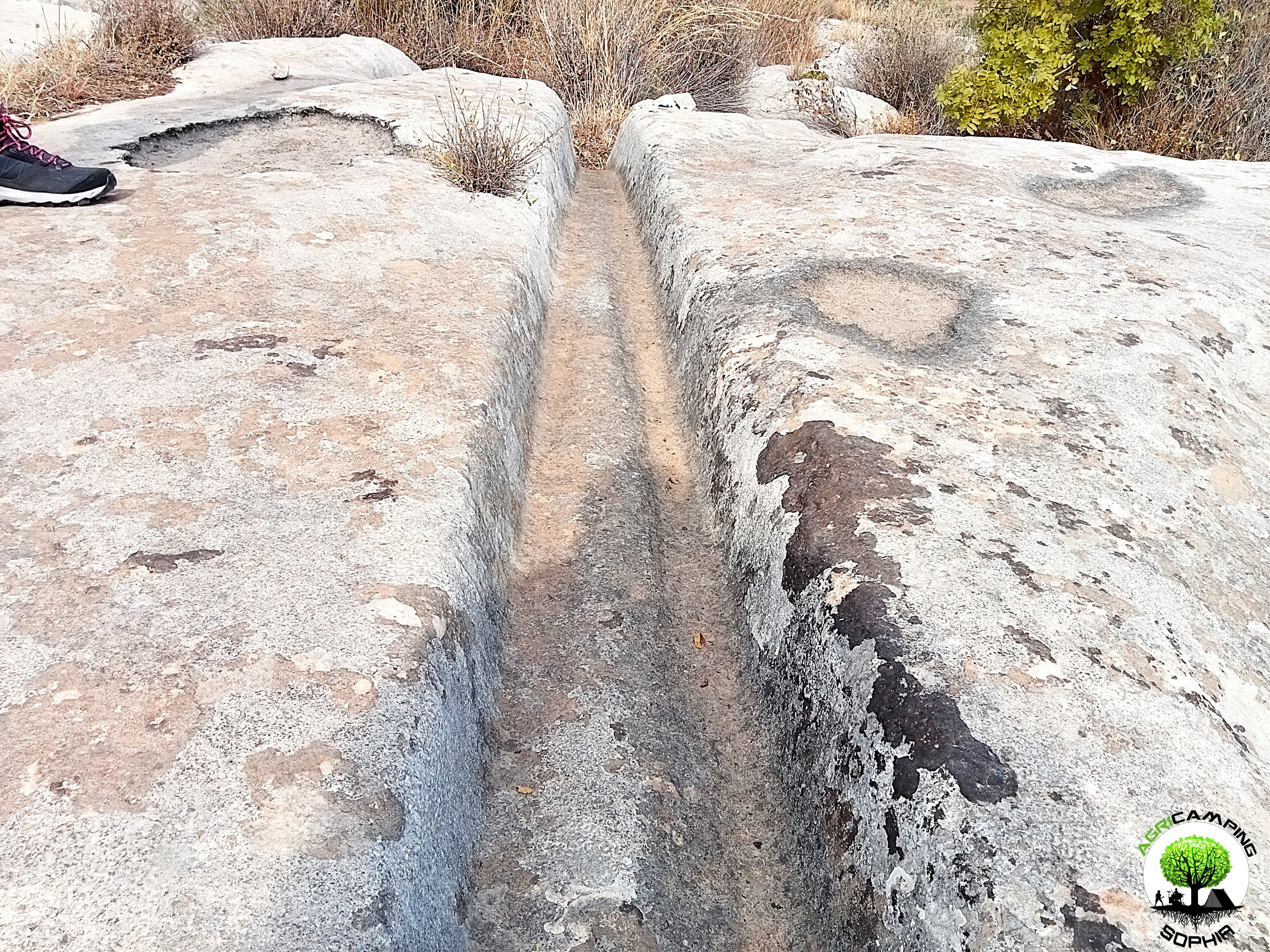
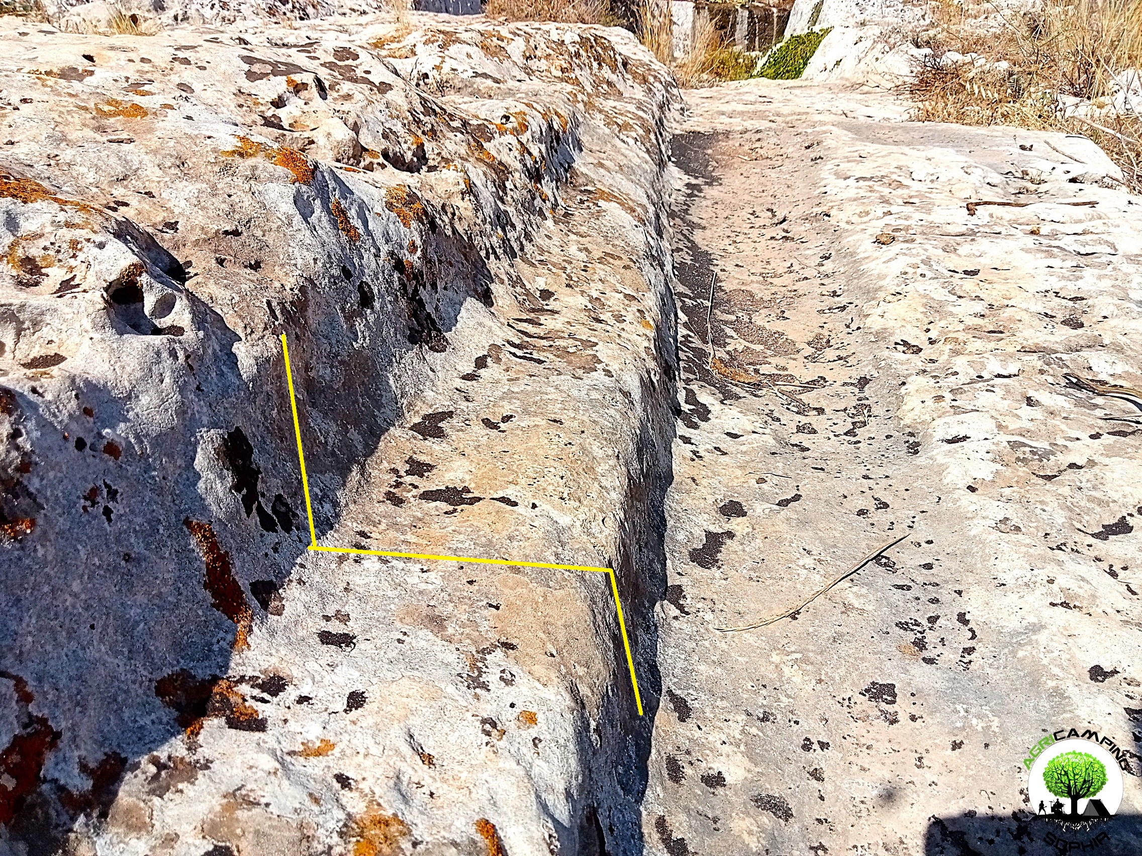
I will skip any preamble, referring to to what has already been written regarding the presence of cart ruts in south-eastern Sicily.As can be seen in other sites around the world, in some cart ruts I visited, in particular in the Cugni district in Pachino, in the Granati Vecchi district in Rosolini and in the Targia district in Syracuse, a clear border can be seen, a sort of frame, next to the grooves, more marked externally, barely noticeable internally.
The borders I measured have a width of 14-20 centimeters and a height of 8-10 centimeters.
Not all cart ruts have such frames present or particularly evident, regardless of the degree of wear or degradation. They are found above all in cart ruts with less deep grooves.
As already described in detail, given the presence of furrows with a depth of even 65-70 centimeters, the wheels of a possible vehicle would have had to have a...
 THE PROBLEM OF CART RUTS IN SOUTH-EASTERN SICILY (PART FOUR)
Click here to return to third part
Clapham Junction
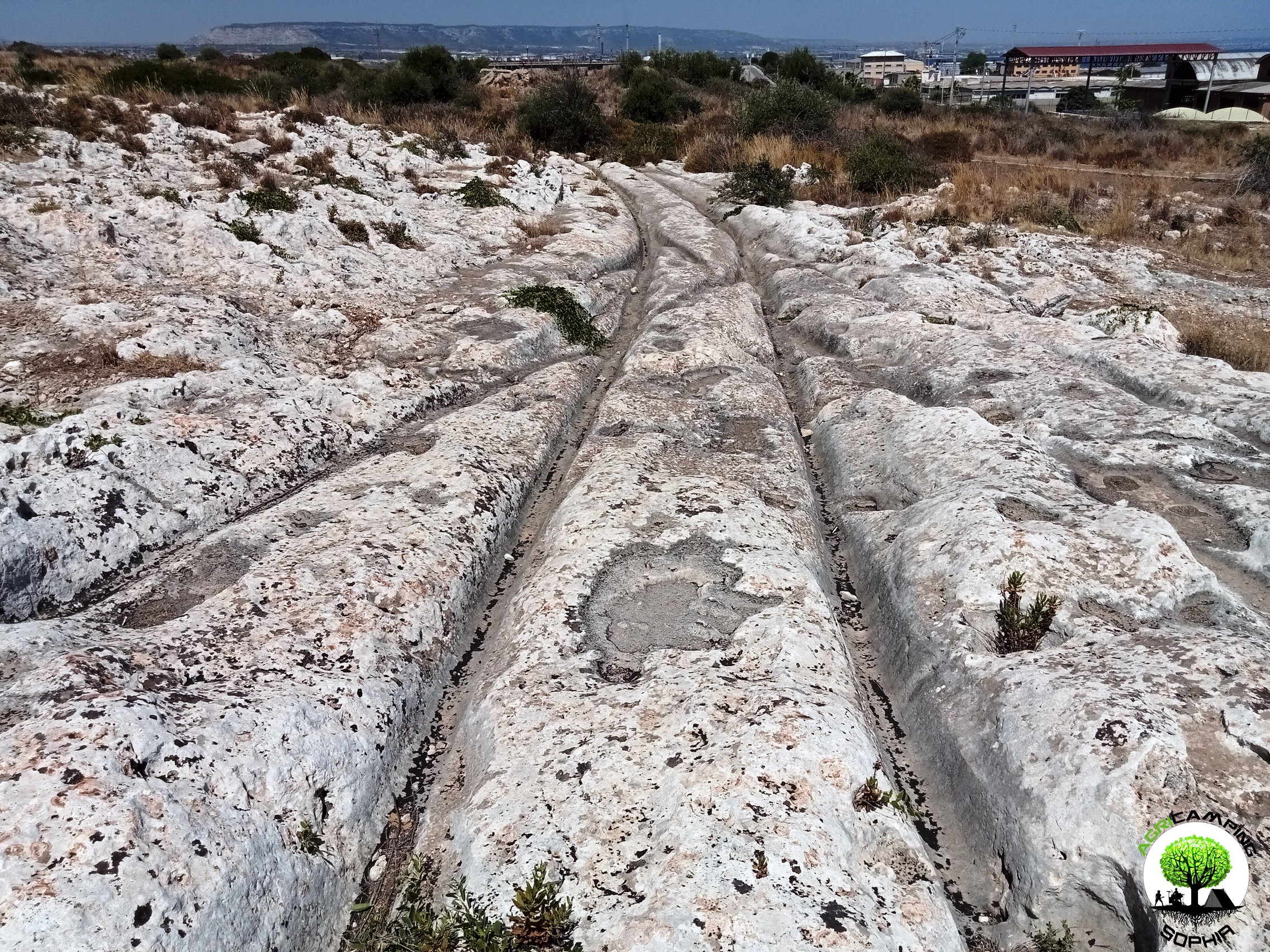
As in the Maltese site Misrah Ghar Il-Kbir, also in the Targia and Granatari Vecchi districts the cart ruts intersect and cross each other in a similar way to the track switches in a railway station. The nickname Clapham Junction that was given by David H. Trump to the Maltese site, derives precisely from the similarity with the famous English railway station. For Sagona these are agricultural furrows and water channels, for Mottershead, Pearson and Schaefer these are abandoned paths due to obstacles and wear. Obviously we do not know what the morphology of the Syracuse and Rosolini territory was at times when the cart ruts were traced, but considering the current context, there certainly would have been no agricultural reason to build them, given the presence of fertile land, springs and fresh water courses just a few kilometers...


 DO YOU WANT TO ORGANIZE AN ERASMUS AT AGRICAMPING SOPHIA?
 CART RUTS MODELED ON SOFT ROCK?
 RACK OR HOUSING FOR CLOGS?
 CART RUTS CUT FROM QUARRIES
 CART RUTS AND A FEW TOO MANY PROJECTIONS
 THE POLISHING OF THE CART RUTS
 THE PROBLEMATIC EDGES OF THE CART RUTS
 THE PROBLEM OF CART RUTS IN SOUTH-EASTERN SICILY (PART FOUR)